News Summary
California is grappling with heightened wildfire risks due to extreme heat and insufficient rainfall, particularly in Southern and Central regions. Recent fires have ignited across Los Angeles and surrounding counties, raising alarm among residents and fire officials. With more than 6.8 million acres classified as fire hazard zones, the situation prompts concerns about community safety and future mitigation efforts. Effective fire management strategies are crucial as the state confronts these escalating fire dangers, urging residents to remain vigilant and informed.
California is facing an increased risk of wildfires across Southern and Central regions due to persistently hot weather and a lackluster rainy season. The situation has raised concerns among fire safety officials, particularly in areas prone to wildfires, as conditions remain ripe for fire start and spread.
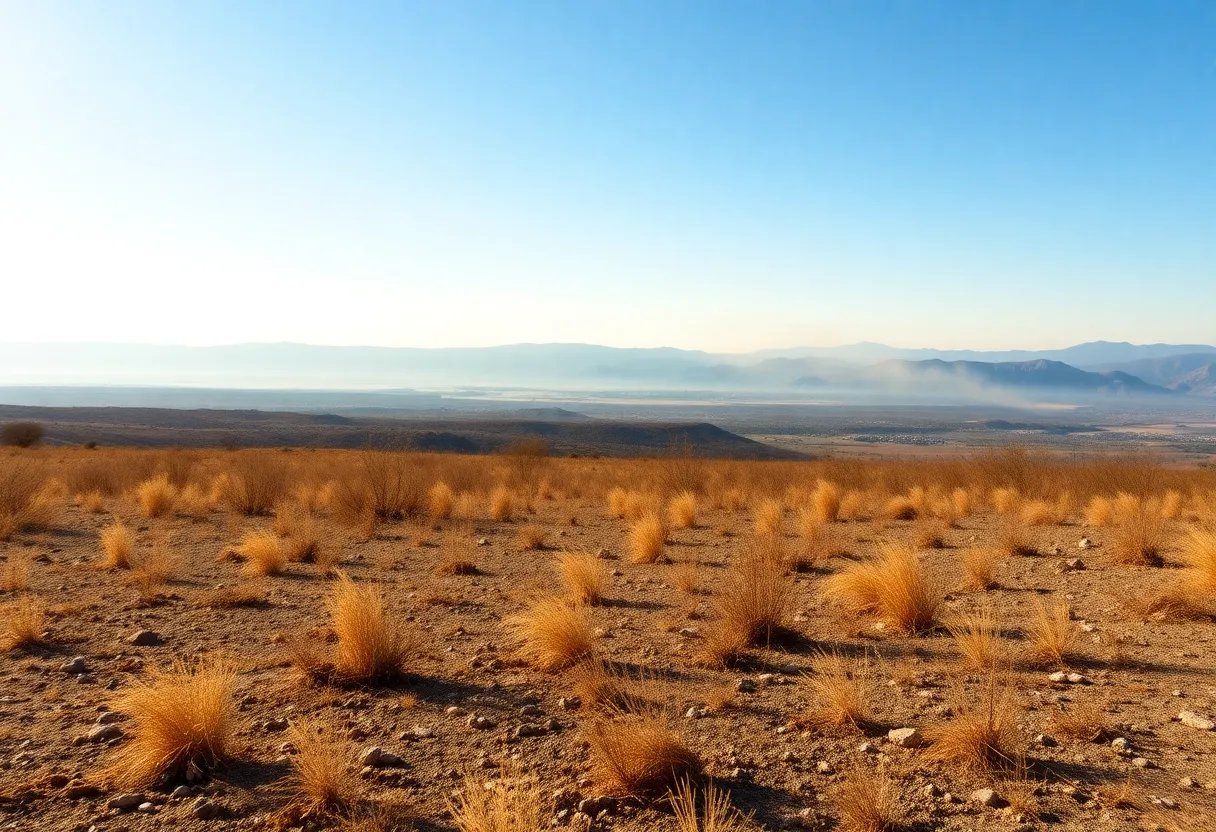
Grassy areas along the coast are still showing some green, but inland regions are experiencing drying conditions that pose a serious risk. This situation is alarming to residents and authorities from the San Fernando Valley to the Sierra foothills in Merced County. Fire behavior analysts indicate that as grasses brown, they become significantly more vulnerable to ignition.
Recently, multiple fires ignited in grassy zones across Los Angeles, San Bernardino, and Riverside counties, highlighting the immediate dangers present. While these grassy fires typically burn quickly, thereby limiting their potential for widespread destruction in the short term, larger fuel sources that provide moisture tend to reduce the risk of large-scale fires for the time being.
Weather and Climate Conditions
The National Weather Service has recently issued and subsequently rescinded a fire weather watch for several areas, including the San Joaquin Valley and the Sierra foothills. This reflects the erratic nature of fire weather conditions in the region. As California heads deeper into the summer months, forecasts indicate that hot weather is expected to remain abundant, with the National Interagency Fire Center predicting an above-normal fire risk for areas throughout the state in June.
Although California’s reservoirs are currently adequate, the warm and dry conditions this spring have caused a faster-than-average lawn melt-off, contributing to projected seasonal runoffs that may drop to just 70% of average for certain watersheds due to underwhelming precipitation this spring. A recent assessment suggests that accelerated snowmelt from rising temperatures is not an isolated issue but a common challenge across the Western United States.
Fire Management Strategies
A prescribed burn project near the Red Bluff Recreation Area has been postponed in light of increasing nationwide fire activity and anticipated extreme fire weather in Southern California. This decision was made to ensure that fire resources remain adequately available for suppression efforts to protect both life and property in these high-risk areas.
Cal Fire has recently released updated wildfire hazard maps that reveal significant fire hazard zones throughout California, largely impacted by climate change. Currently, 6.8 million acres are classified as fire hazard zones, representing a substantial increase. Northern California has seen significant growth in these zones, while counties in Southern California, including Los Angeles and Riverside, have also been noted for extensive areas under high fire risk.
Impact on Communities
Los Angeles County currently has 314,000 acres classified as “very high hazard,” which follows a series of recent fire episodes. The new hazard maps account for various considerations including topography, fire weather, flame length, historical fire incidents, and vegetation types. Residents are encouraged to familiarize themselves with these new hazard classifications and explore mitigation strategies to reduce fire risks on their properties.
While it is uncertain if the new hazard maps will result in direct increases in insurance rates, existing fire incidents have the potential to drive costs up and limit availability of coverage in fire-prone regions. According to estimates, around 90% of homes in wildfire-prone locations were built before newer building standards were implemented.
Looking Ahead
The new classifications also underline that even areas not traditionally considered wildland are now susceptible to wildfires due to factors like ember spread. State and local governments have a deadline of 120 days to adopt these new hazard maps, and public comments are expected as part of the review process.
California officials are proactively addressing the escalating risks posed by changing fire conditions, encouraging residents to remain vigilant and educated about fire safety amid fluctuating weather patterns.
Deeper Dive: News & Info About This Topic
- KRCRTV: Red Bluff Prescribed Burn Postponed Due to Increased Fire Risk
- San Francisco Chronicle: Cal Fire Risk Map
- Daily News: Southern California Fire Danger Zones Increase 76%
- Insurance Insider: Wildfire Risk in California
- ABC30: What to Know About California’s New Fire Hazard Maps
- Wikipedia: Wildfires in California

Author: STAFF HERE HOLLYWOOD
The Hollywood Staff Writer represents the experienced team at HEREHollywood.com, your go-to source for actionable local news and information in Hollywood, Los Angeles County, and beyond. Specializing in "news you can use," we cover essential topics like product reviews for personal and business needs, local business directories, politics, real estate trends, neighborhood insights, and state news affecting the area—with deep expertise drawn from years of dedicated reporting and strong community input, including local press releases and business updates. We deliver top reporting on high-value events such as the Hollywood Bowl summer concerts, the Hollywood Christmas Parade, film premieres at TCL Chinese Theatre, and festivals at the Magic Castle. Our coverage extends to key organizations like the Hollywood Chamber of Commerce and Visit Hollywood, plus leading businesses in entertainment, dining, and tourism that define the local economy. As part of the broader HERE network, including HERELosAngeles.com, HEREBeverlyHills.com, HEREAnaheim.com, and HEREHuntingtonBeach.com, we provide comprehensive, credible insights into Southern California's dynamic landscape.