News Summary
Southern California has released new fire hazard maps showing a troubling 76% increase in areas subject to stricter fire safety codes. The maps indicate a 26% rise in ‘very high fire hazard severity zones,’ affecting residents in eight counties. Homeowners are now required to implement fire safety measures, including maintaining defensible space around their properties. The growing areas affected highlight the urgent need for enhanced fire safety protocols as climate conditions continue to evolve.
California’s Flame-Fighting Focus: New Fire Hazard Maps Unveiled
In Southern California, the landscape of fire hazards is changing rapidly, and the latest fire hazard maps released on March 24 paint a sobering picture. The new data shows a staggering 76% increase in the number of acres falling under the jurisdiction of stricter fire-safe building codes. This significant spike has heightened concerns about fire safety for thousands of residents across the region.
What’s New in the Fire Maps?
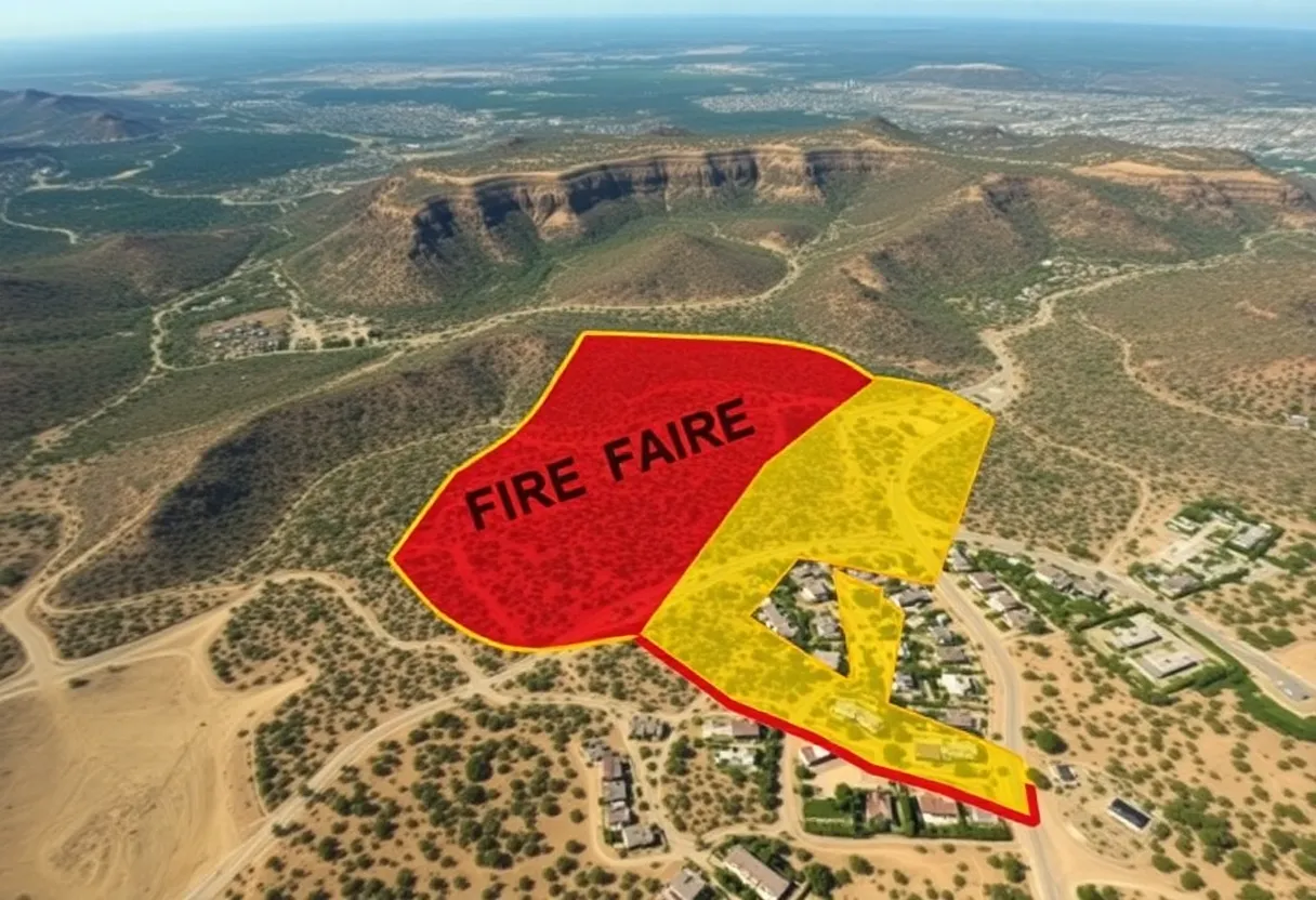
The updated maps indicate a 26% rise in areas classified as “very high fire hazard severity zones.” This designation impacts even more homeowners, as it requires them to take proactive measures—like clearing flammable plants from their properties and undergoing inspections before selling their homes. The changes affect eight counties including Los Angeles, Orange, Riverside, San Bernardino, San Diego, Imperial, Inyo, and Mono, making it impossible for residents to ignore the growing need for fire safety.
Previously, the five most populous counties in Southern California had very high fire zones covering about 644,000 acres. Today, that number has jumped to over 812,000 acres. All combined, the areas labeled as high and very high fire zones now reach an alarming total of over 1.1 million acres. This isn’t just a minor upgrade; it’s a wake-up call for local residents and officials alike!
Where Are These Changes Happening?
It’s worth noting that while some cities have seen a reduction in their very high hazard zones, significant expansion has occurred in others. Jurupa Valley in Riverside County, for example, skyrocketed from just 226 to 6,195 acres designated as very high fire hazard. On the other end, five cities that once faced high hazard designations now have none, while 35 other cities—including Santa Monica and La Cañada-Flintridge—are newly marked as high fire risk areas. This shifting alignment of fire zones is indicative of the changing environment and weather patterns affecting the state.
What Do Homeowners Need to Know?
With the vitality of homeowner safety at stake, these updated hazard maps come with new responsibilities. Residents living within very high fire hazard zones will now be required to maintain what is known as “defensible space” within 100 feet around their buildings and undergo inspections to ensure they comply with the necessary fire safety measures. Not only that, but any construction projects in these danger zones must meet the stringent requirements laid out in Chapter 7A of the state building code—designed specifically to promote ember-resistant features.
Moreover, California is drafting new “Zone 0” rules that will further bolster fire safety. These new guidelines propose that homeowners remove flammable materials from the first five feet surrounding their homes, adding another layer of protection against the spread of fires.
The Bigger Picture
Across California, a remarkable 35% increase in statewide very high fire zones has occurred since 2011, now covering 1.16 million acres. The combined area designated as either high or very high totals about 2.3 million acres. With weather patterns rapidly shifting and contributing to these newfound fire risks, it’s clear that proactive measures are essential for mitigating potential fire hazards.
Community responses to the updated maps are expected to range from acceptance to concern. Nonetheless, it seems likely that residents will adapt to these increased regulations as they acknowledge the importance of fire safety amidst a backdrop of evolving climate conditions.
As we venture further into what could be a dangerous wildfire season, it’s critical that we all recognize the severity of these changes and do our part to ensure the safety of our communities. The new fire hazard maps serve as a vital reminder that more needs to be done to protect our homes and our landscapes from the threat of wildfires. It’s about time we take those proactive steps!
Deeper Dive: News & Info About This Topic
- Los Angeles Times: Wildfire Hazard Zones
- LAist: Fire Hazard Severity in LA County
- Daily News: Fire Danger Zones Increase
- CBS News: Cal Fire Hazard Maps
- Wikipedia: Wildfire